Computational urban morphology study of Ferizaj (municipality population 109,255, 2024 Kosovo census). The work reads the city as a monocentric radial-linear system structured by a railway seam and arterial logic. Click a figure to open the research sidebar (method, parameters, architectural reading).
Figures
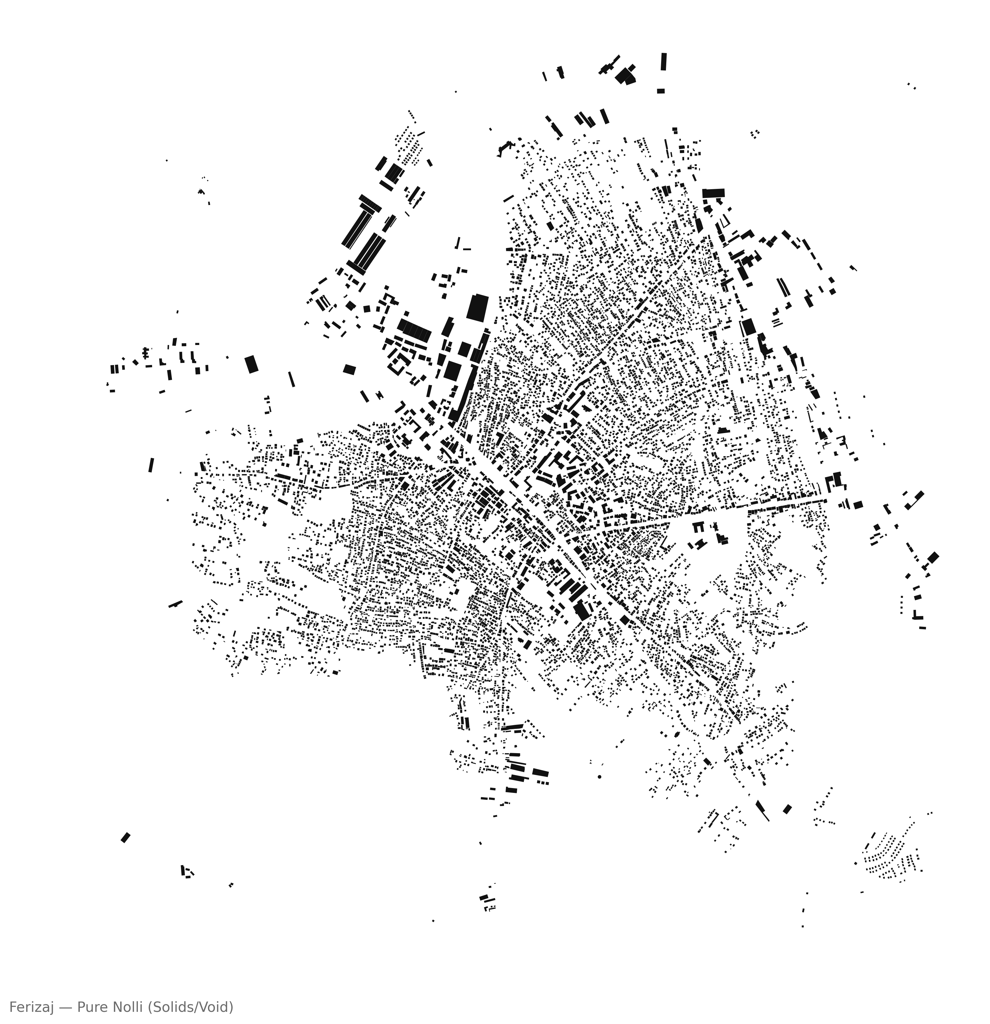
01 Nolli Pure
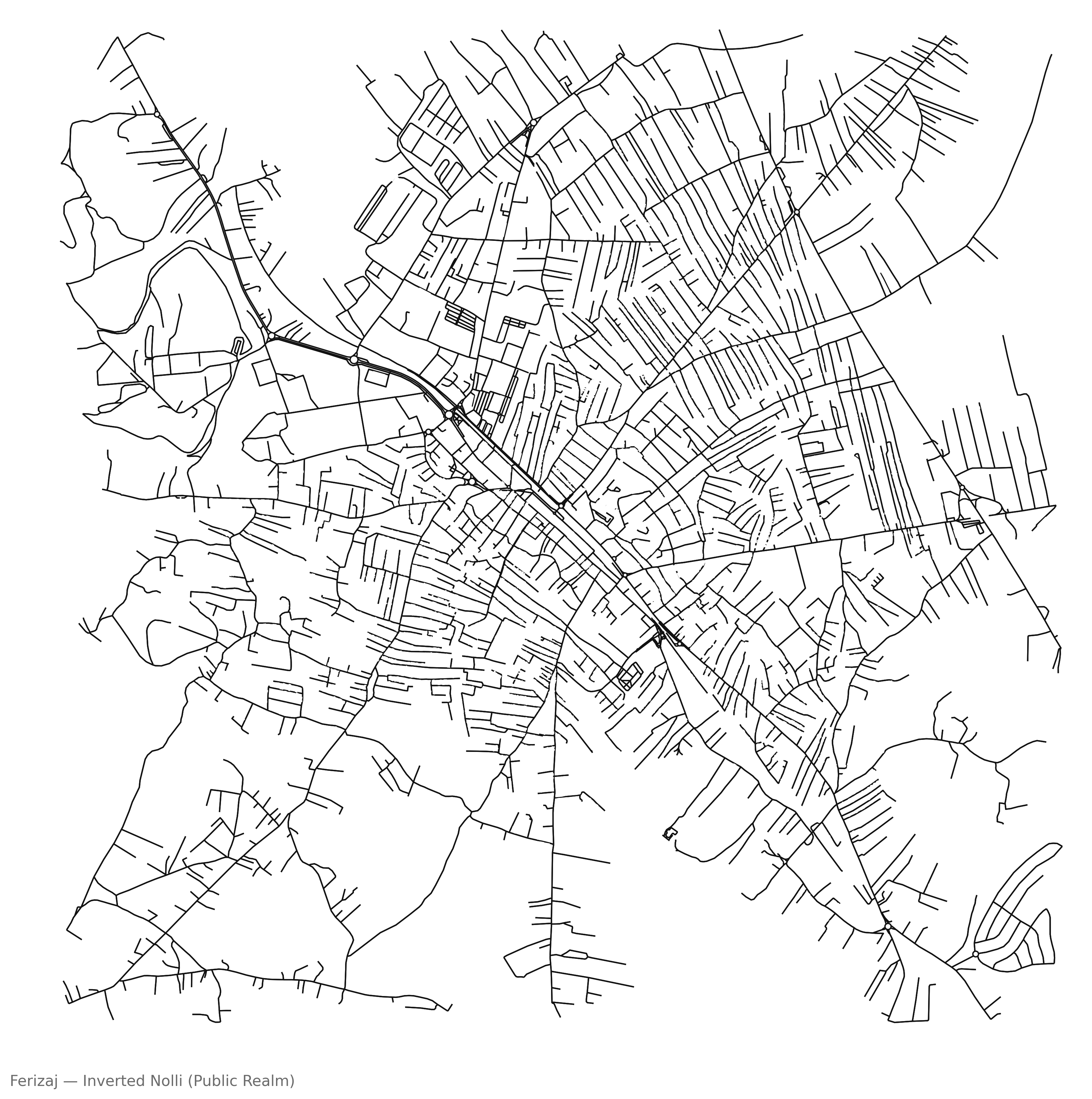
02 Nolli Inverted
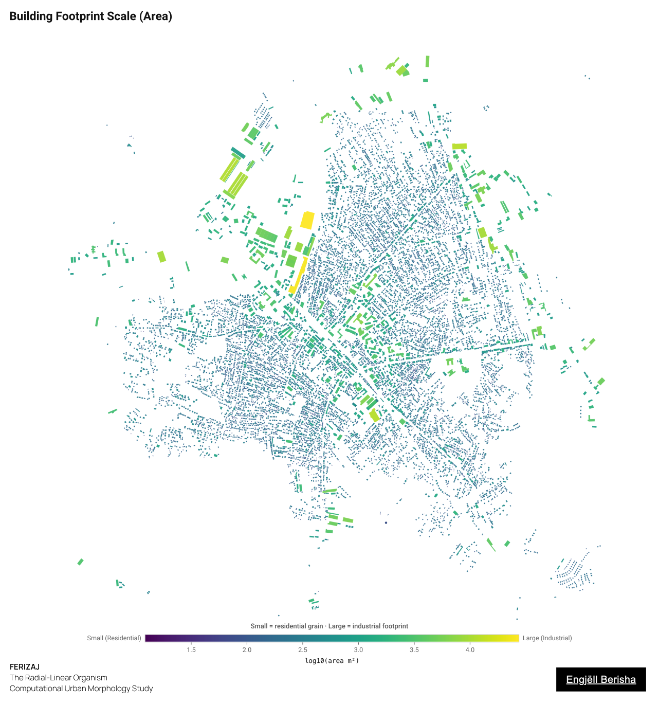
04 Building Footprint Scale
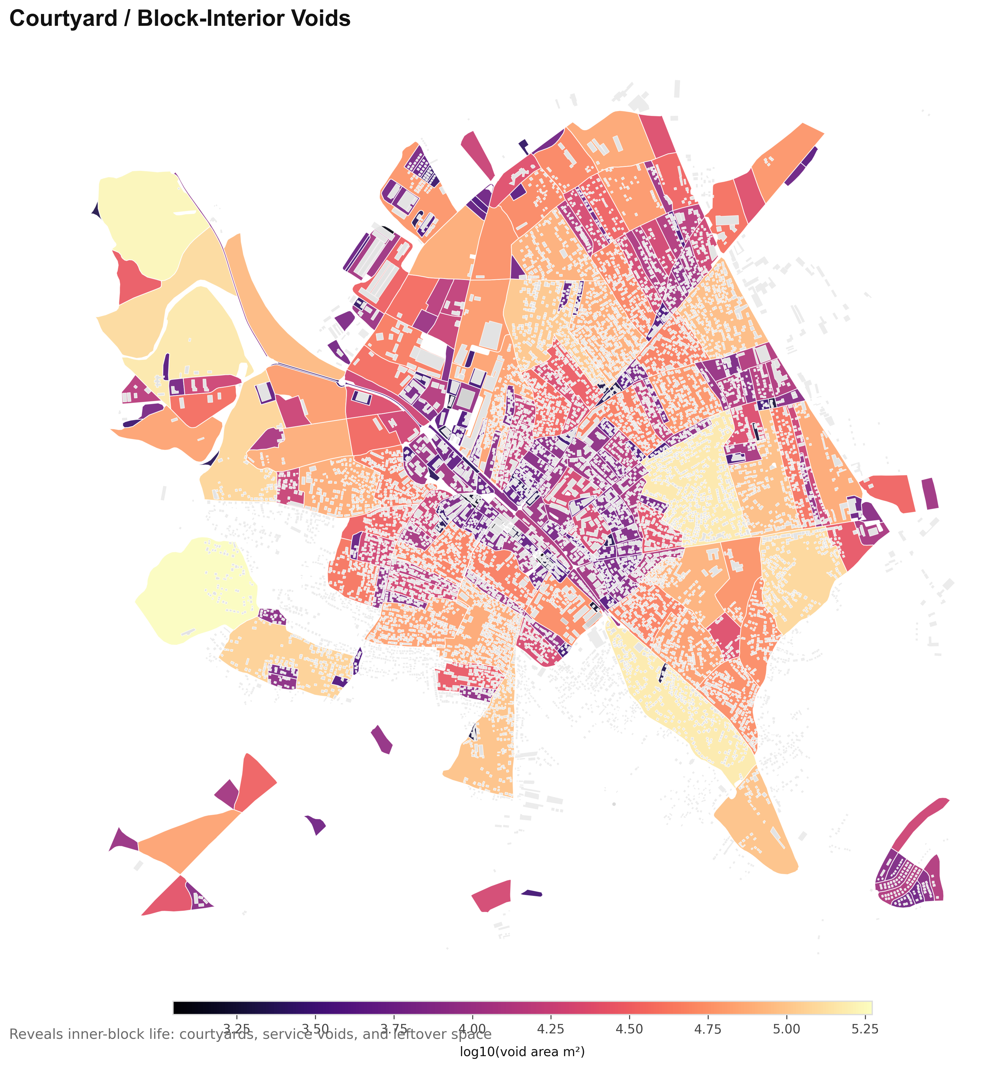
13 Courtyard Voids
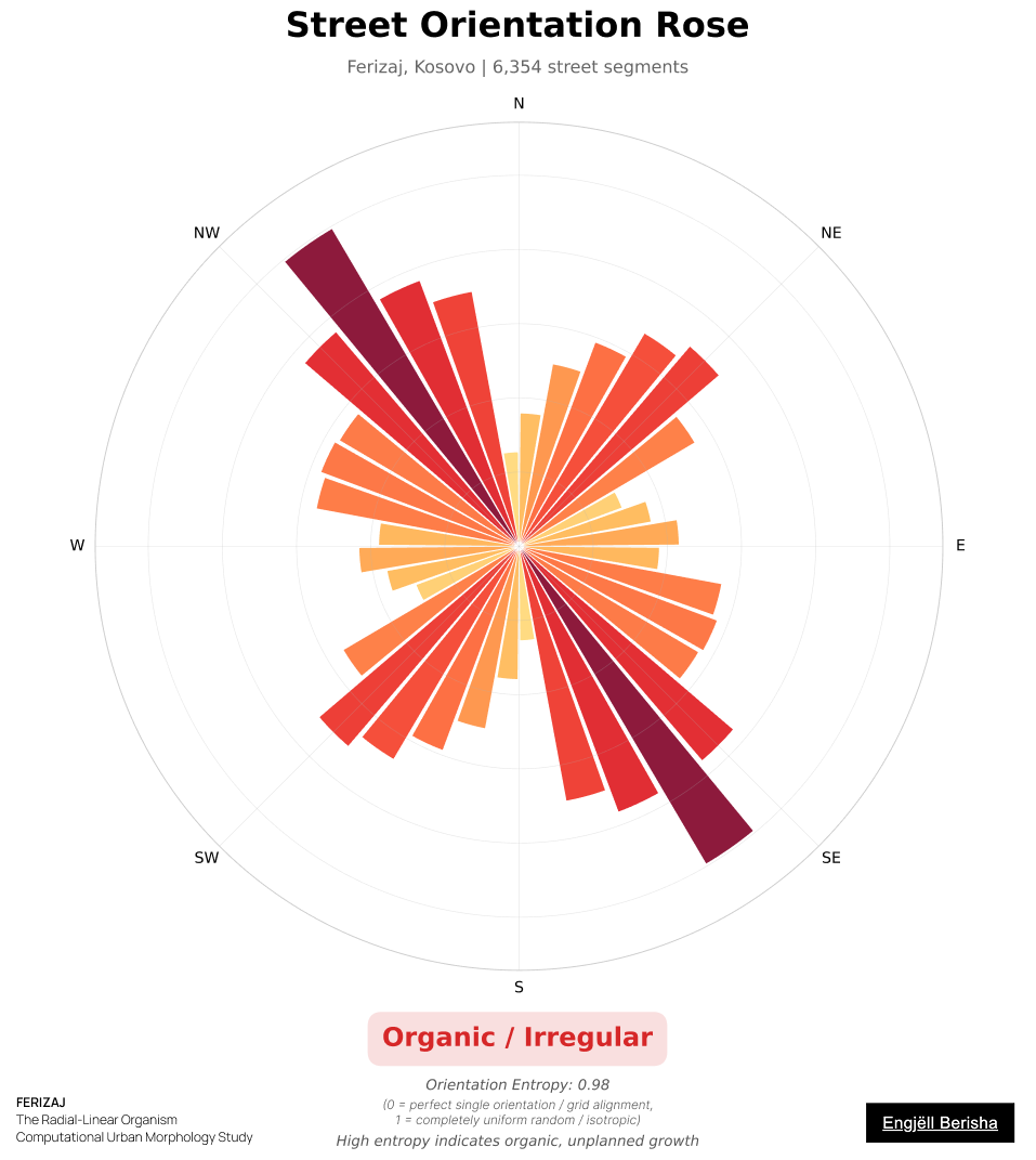
42 Street Orientation
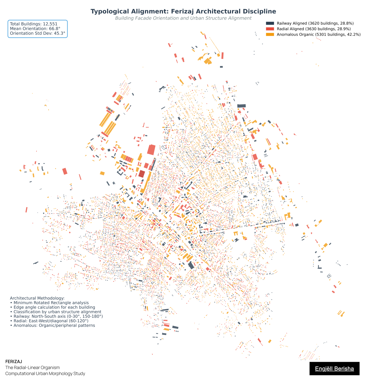
18 Typological Alignment
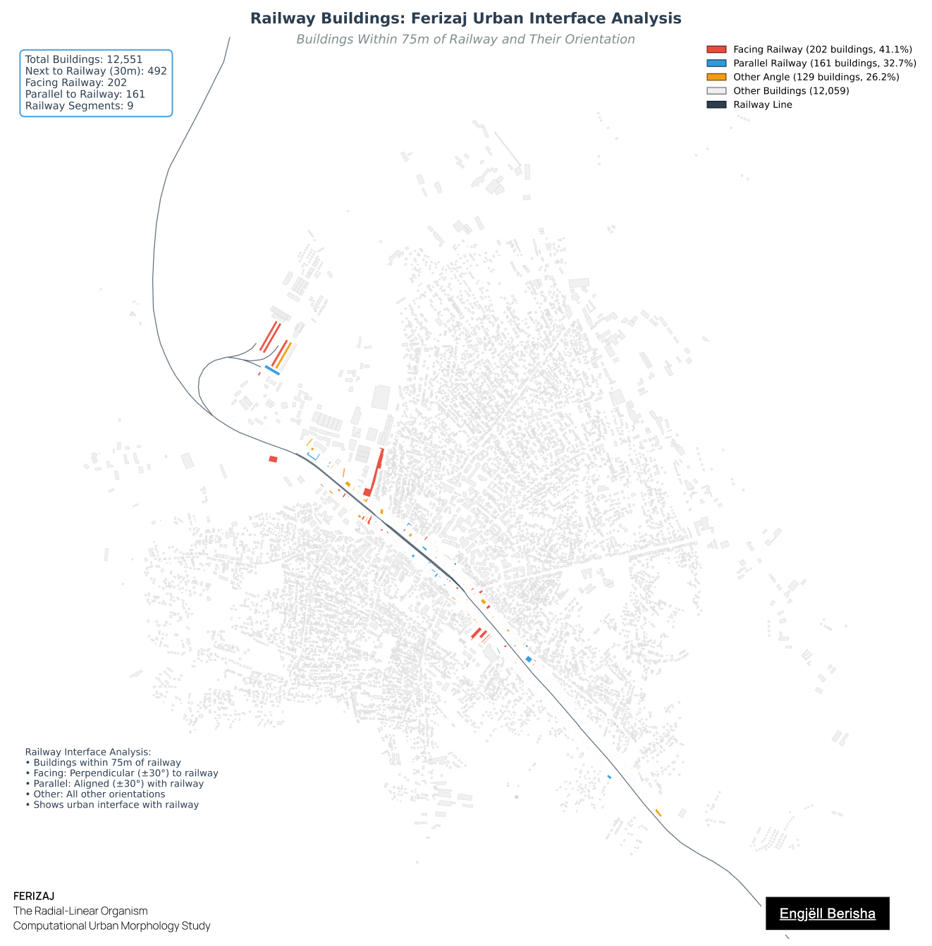
18 Railway Buildings
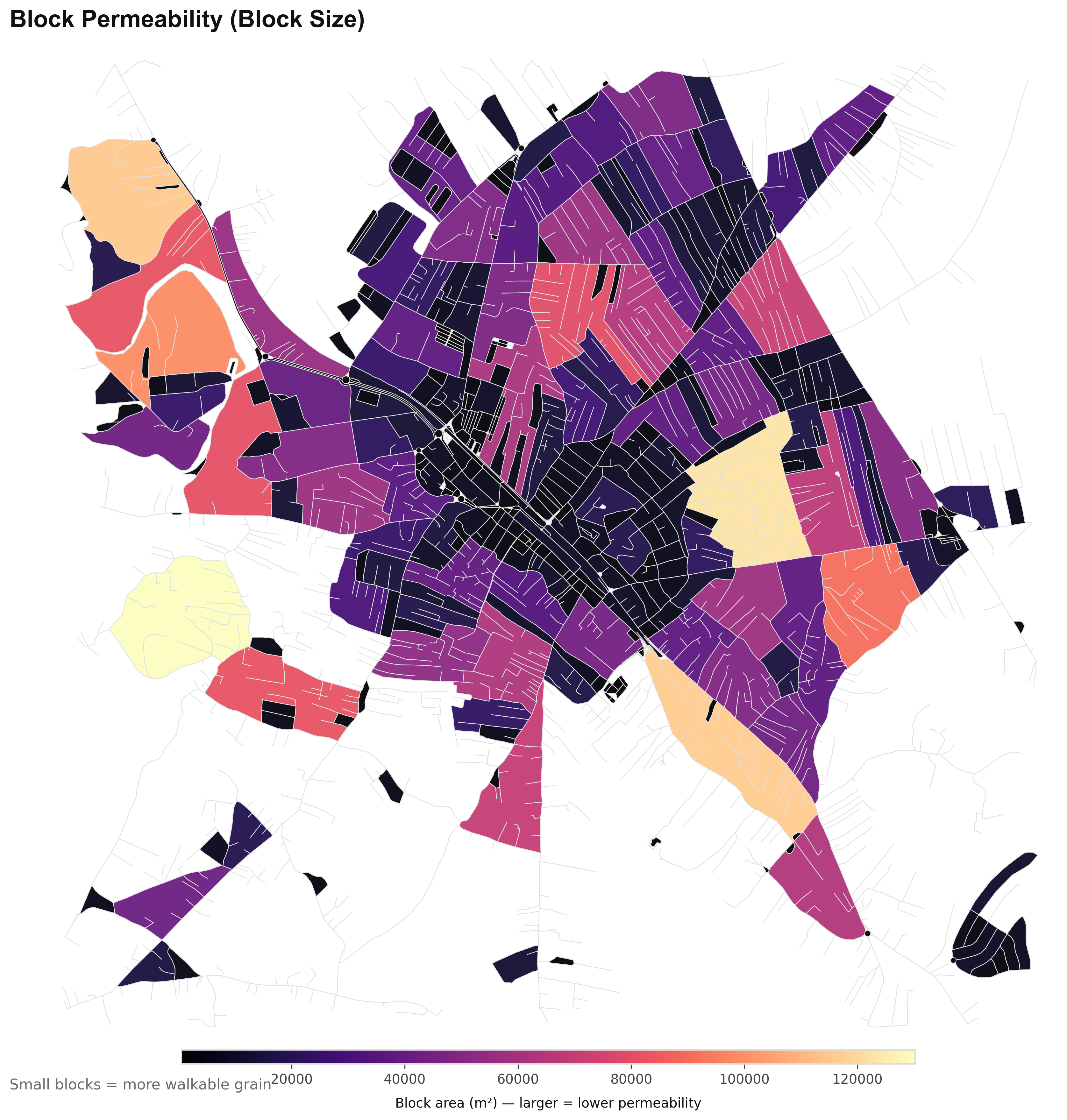
05 Block Permeability
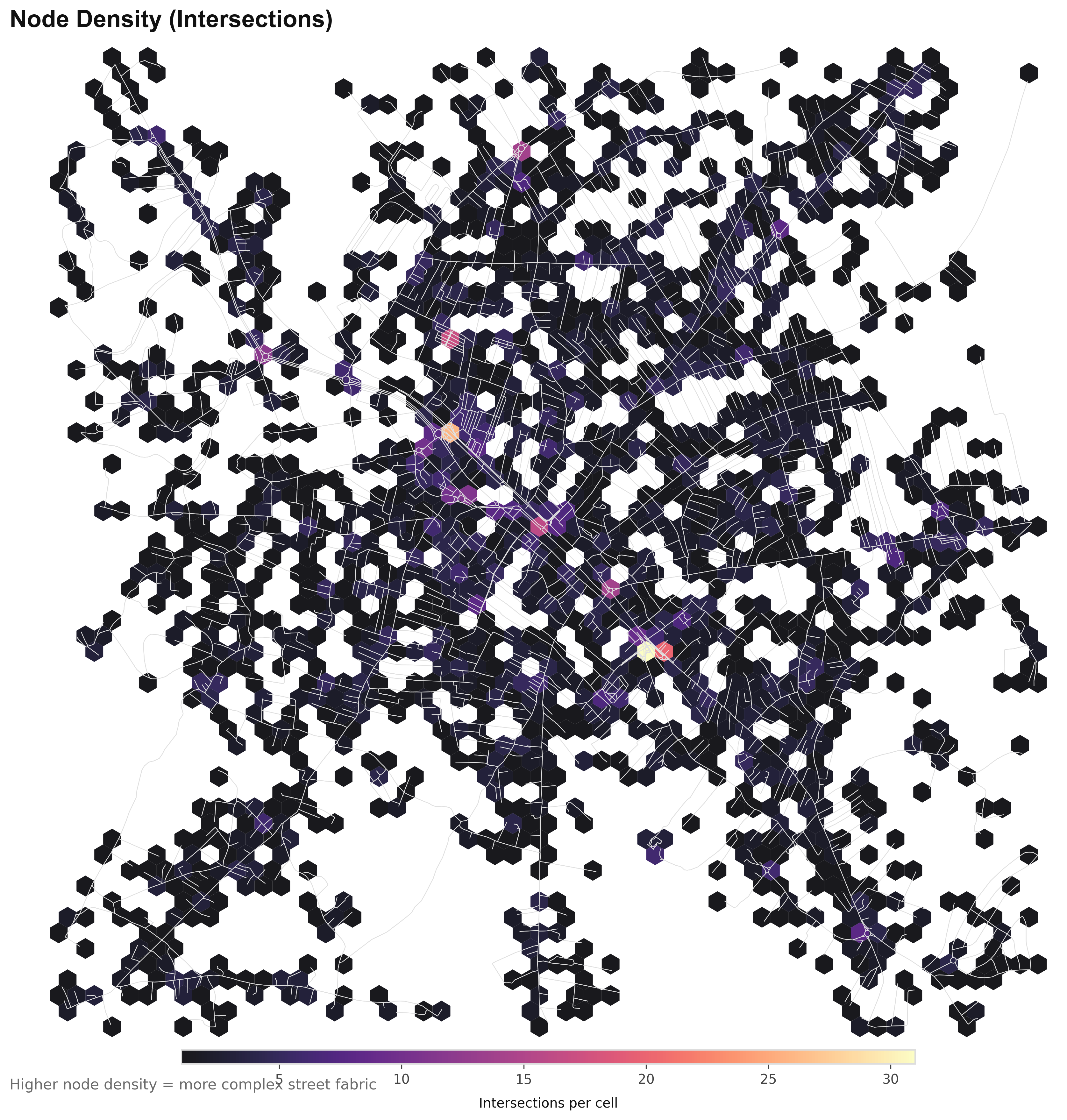
06 Node Density
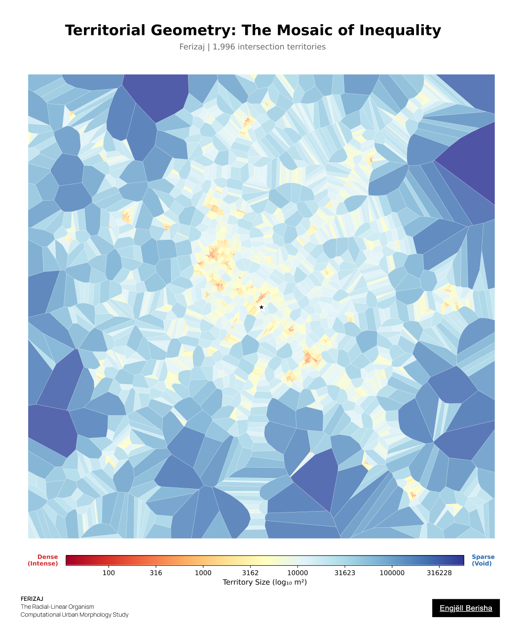
48 Voronoi Mosaic
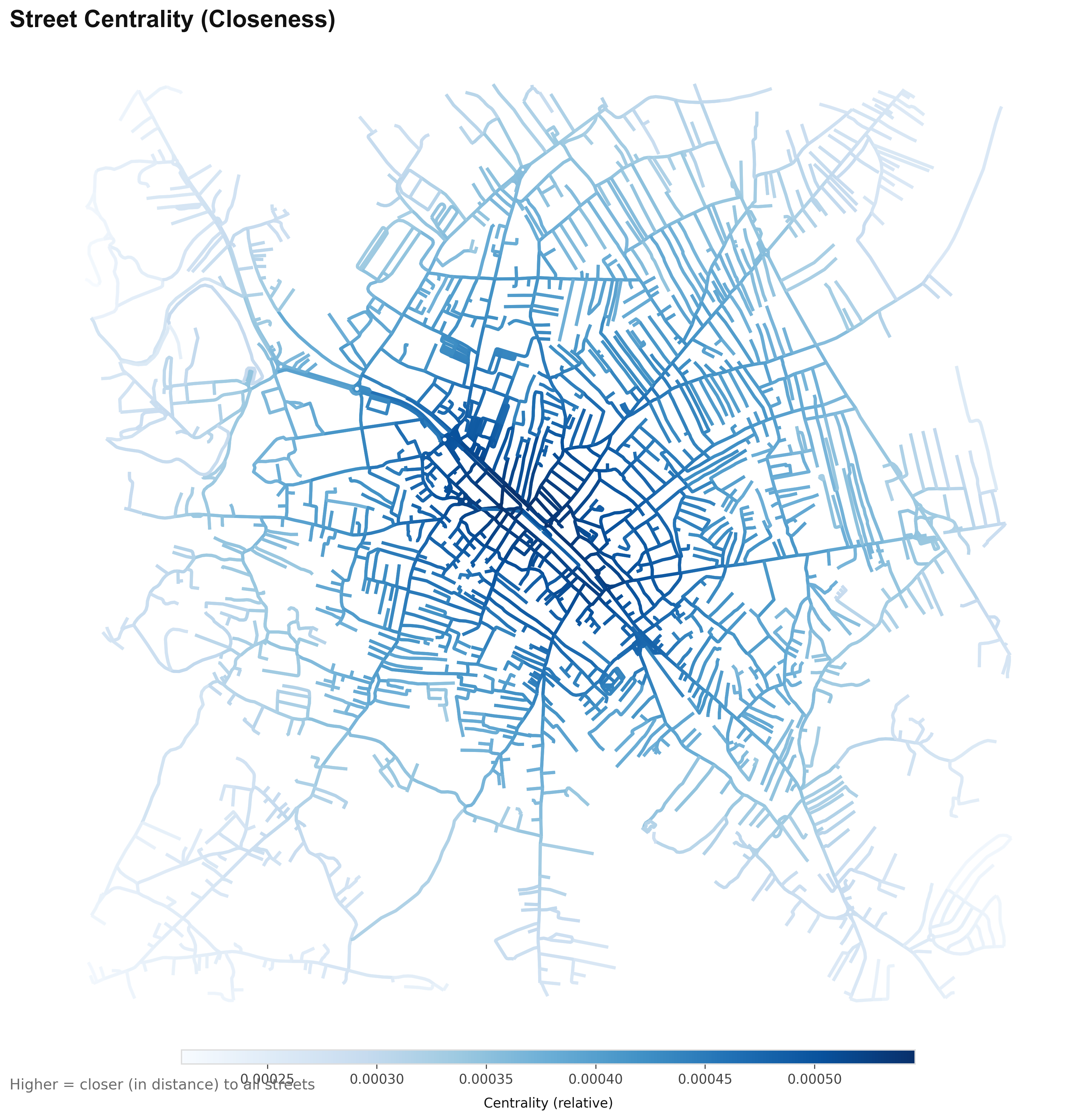
07 Street Centrality
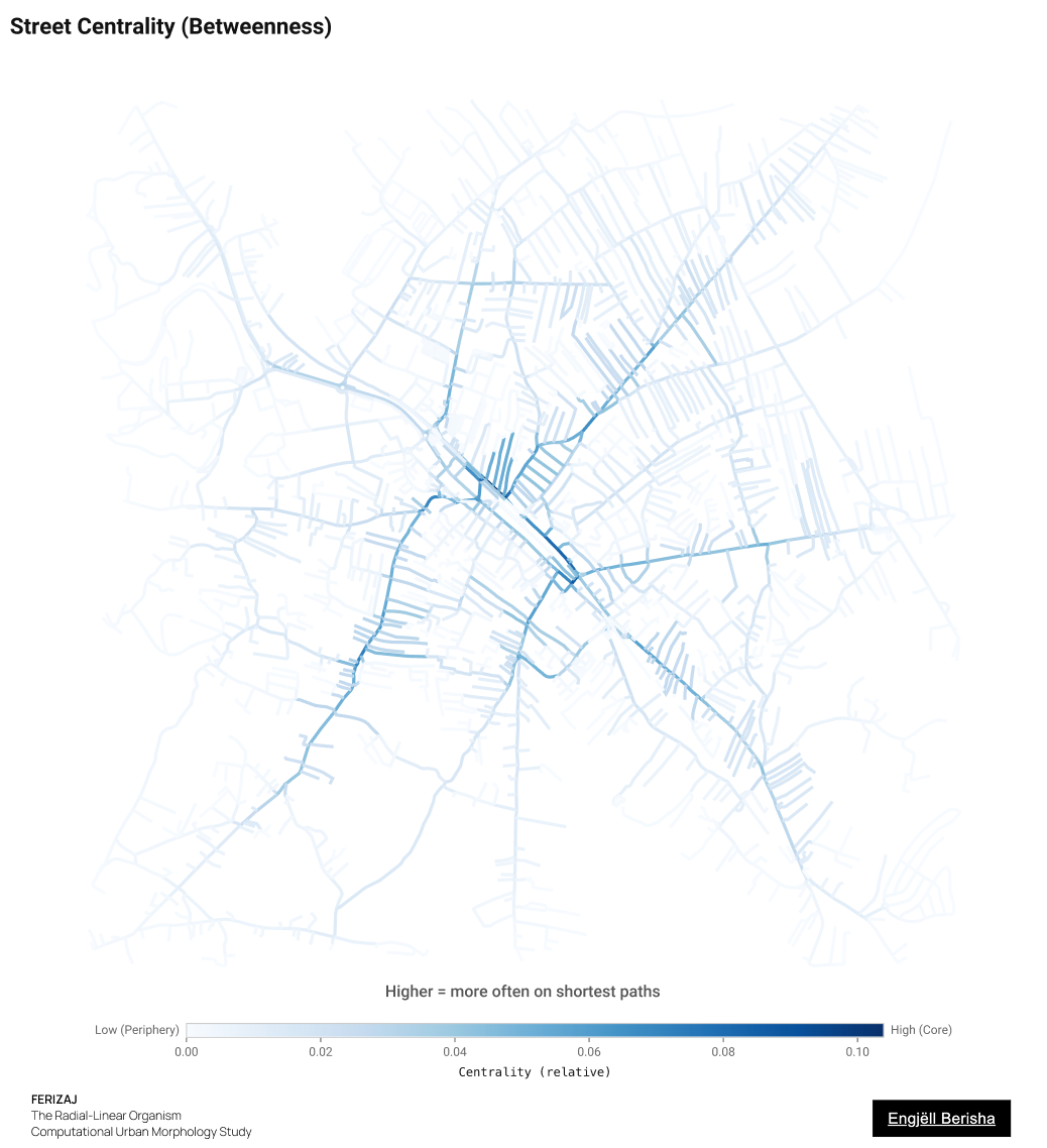
07 Betweenness
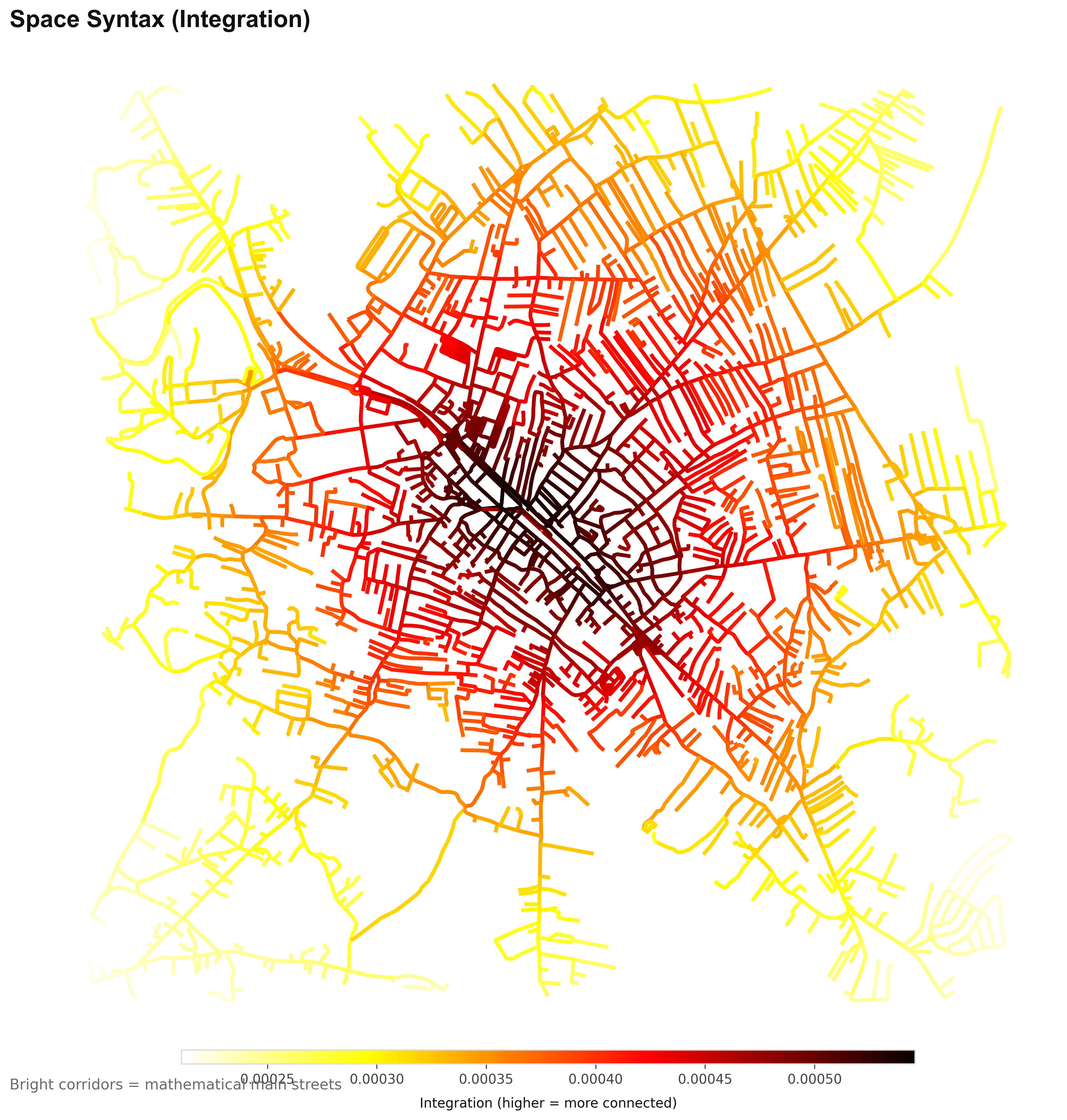
10 Space Syntax
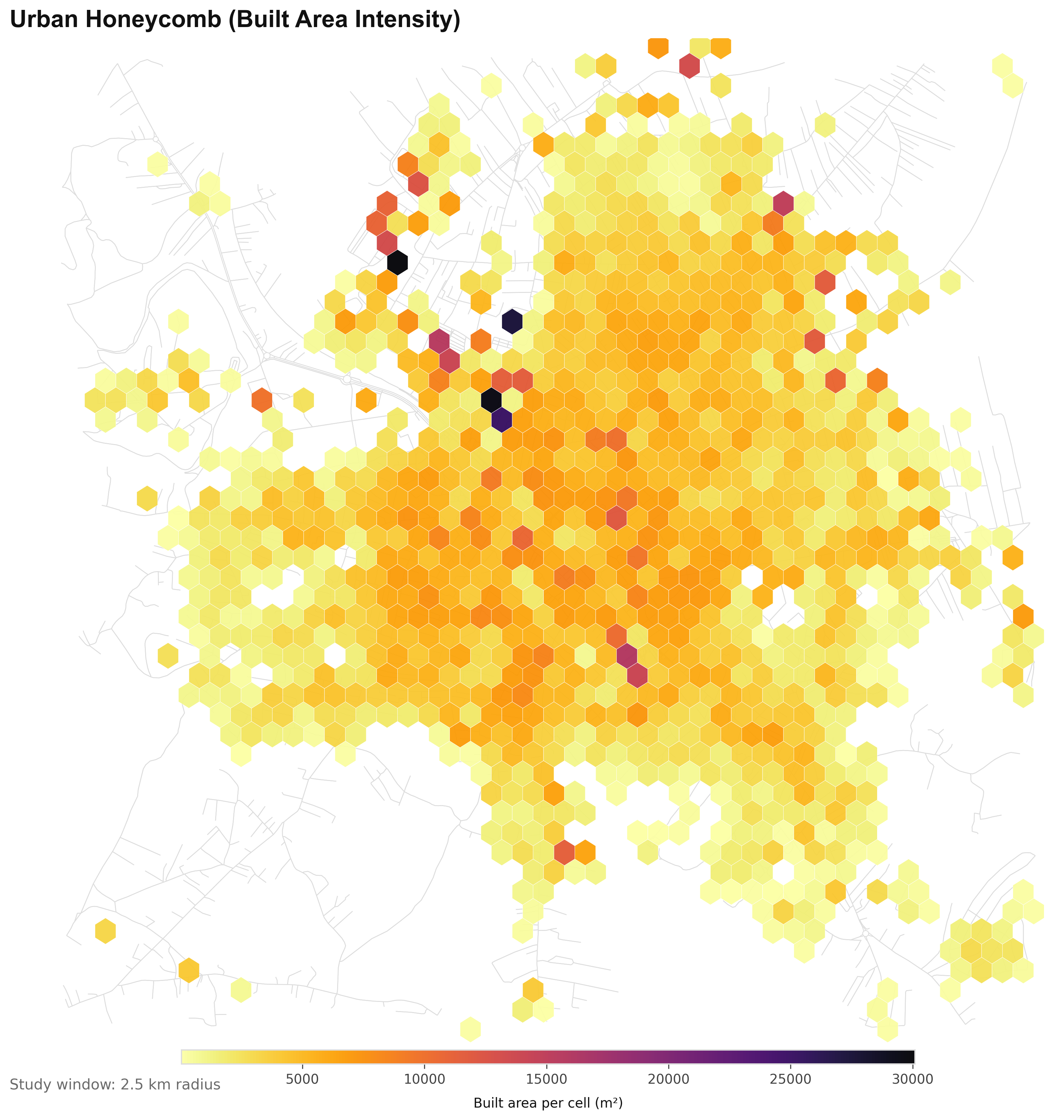
03 Urban Honeycomb
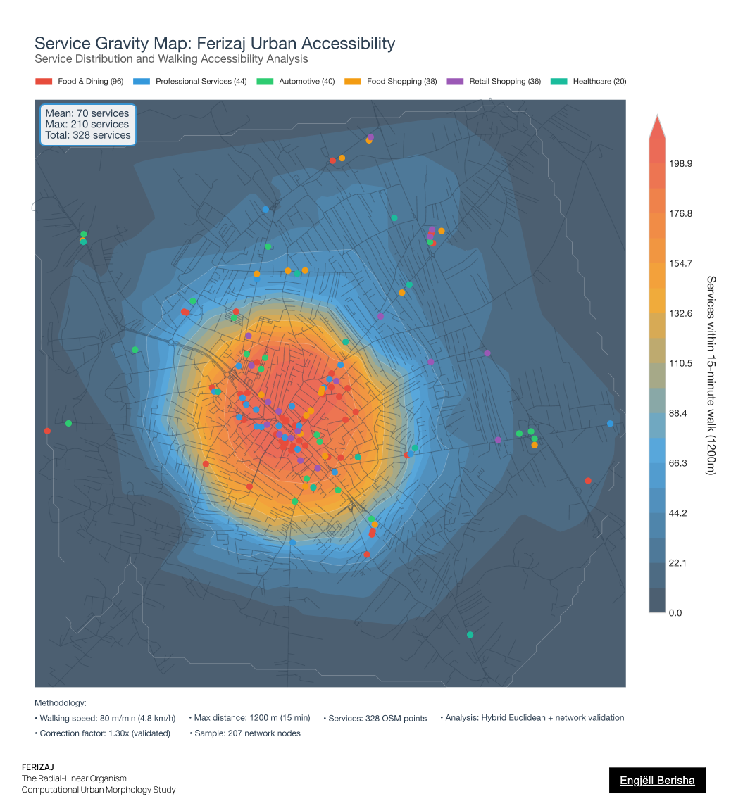
16 Service Gravity
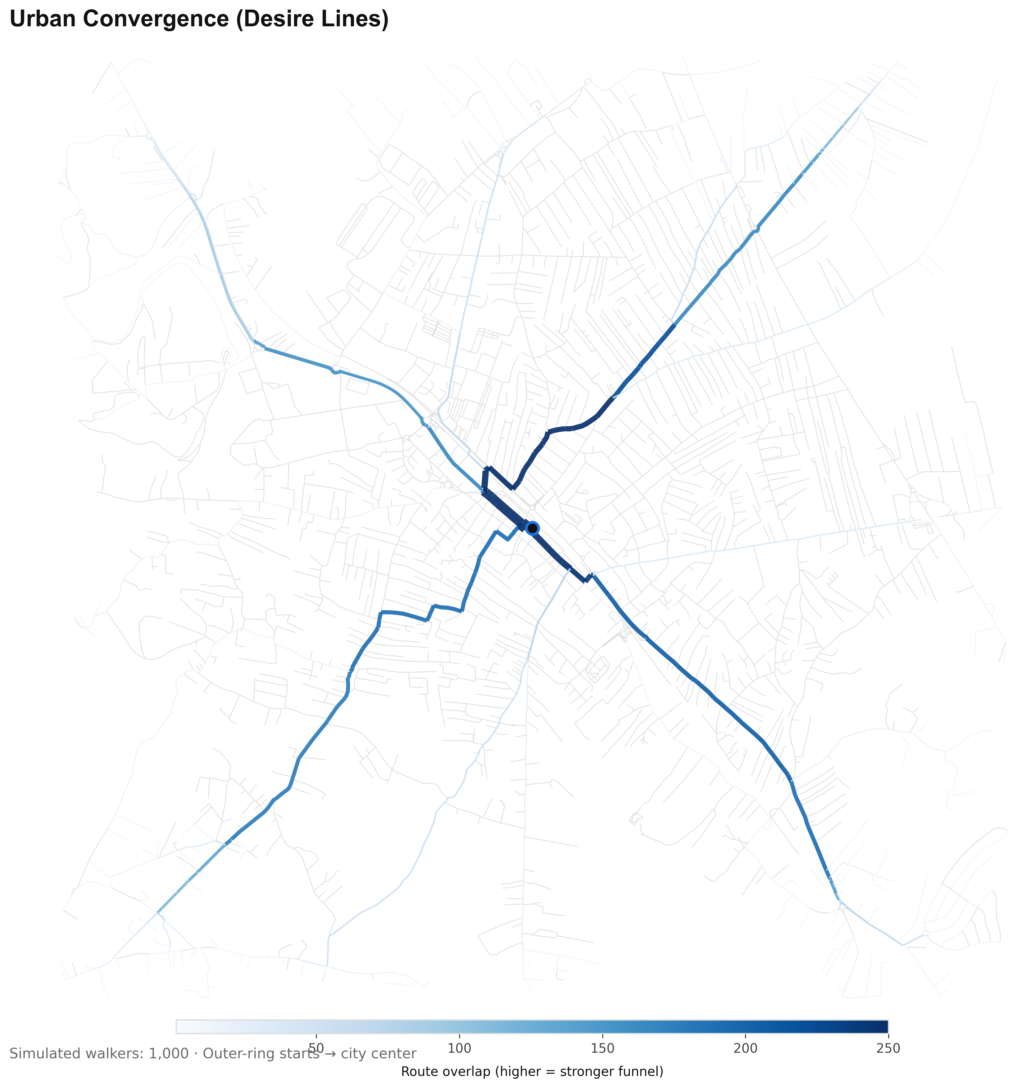
09 Urban Convergence
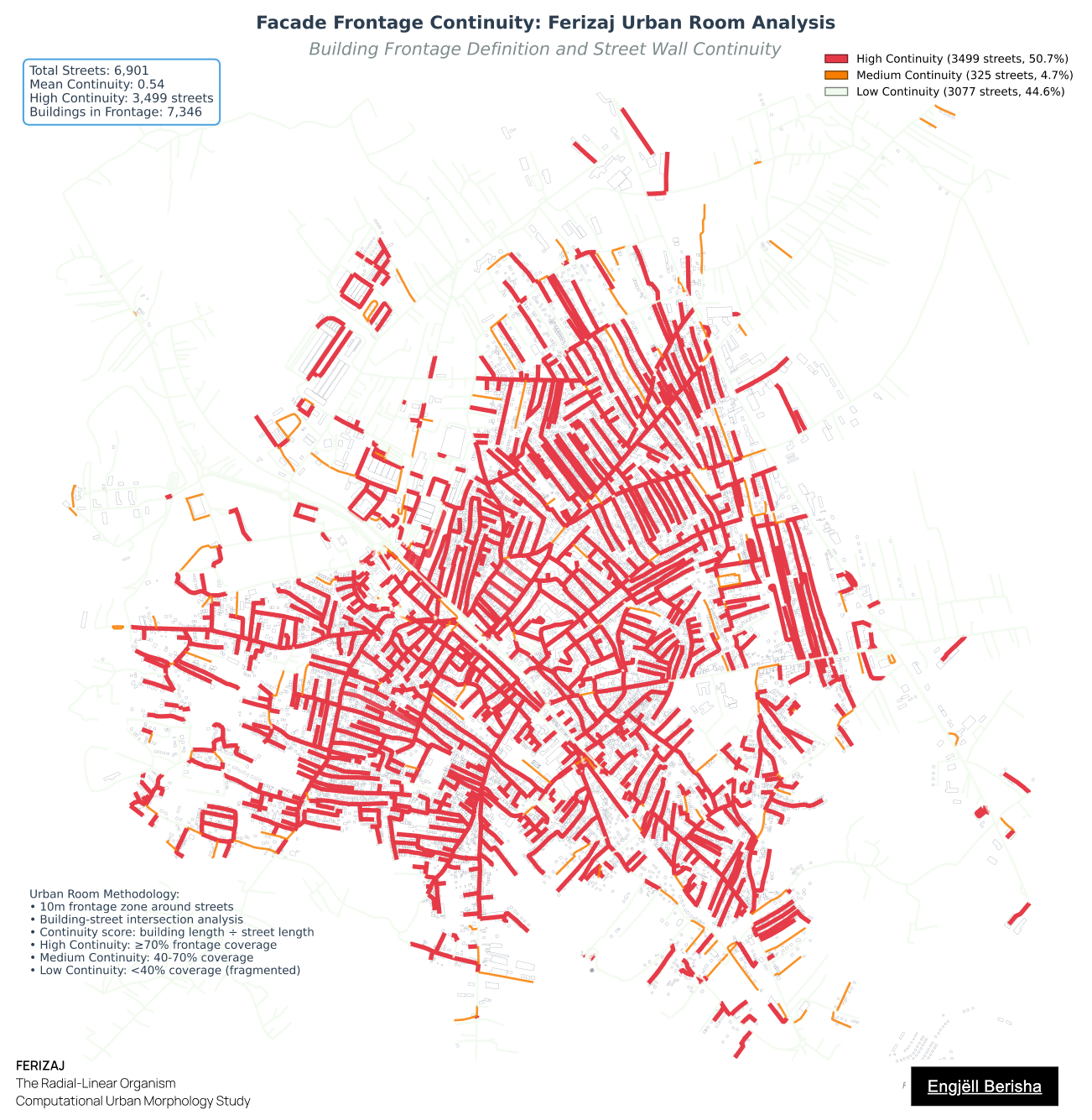
19 Facade Continuity
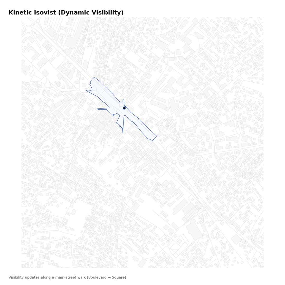
11 Isovist Field
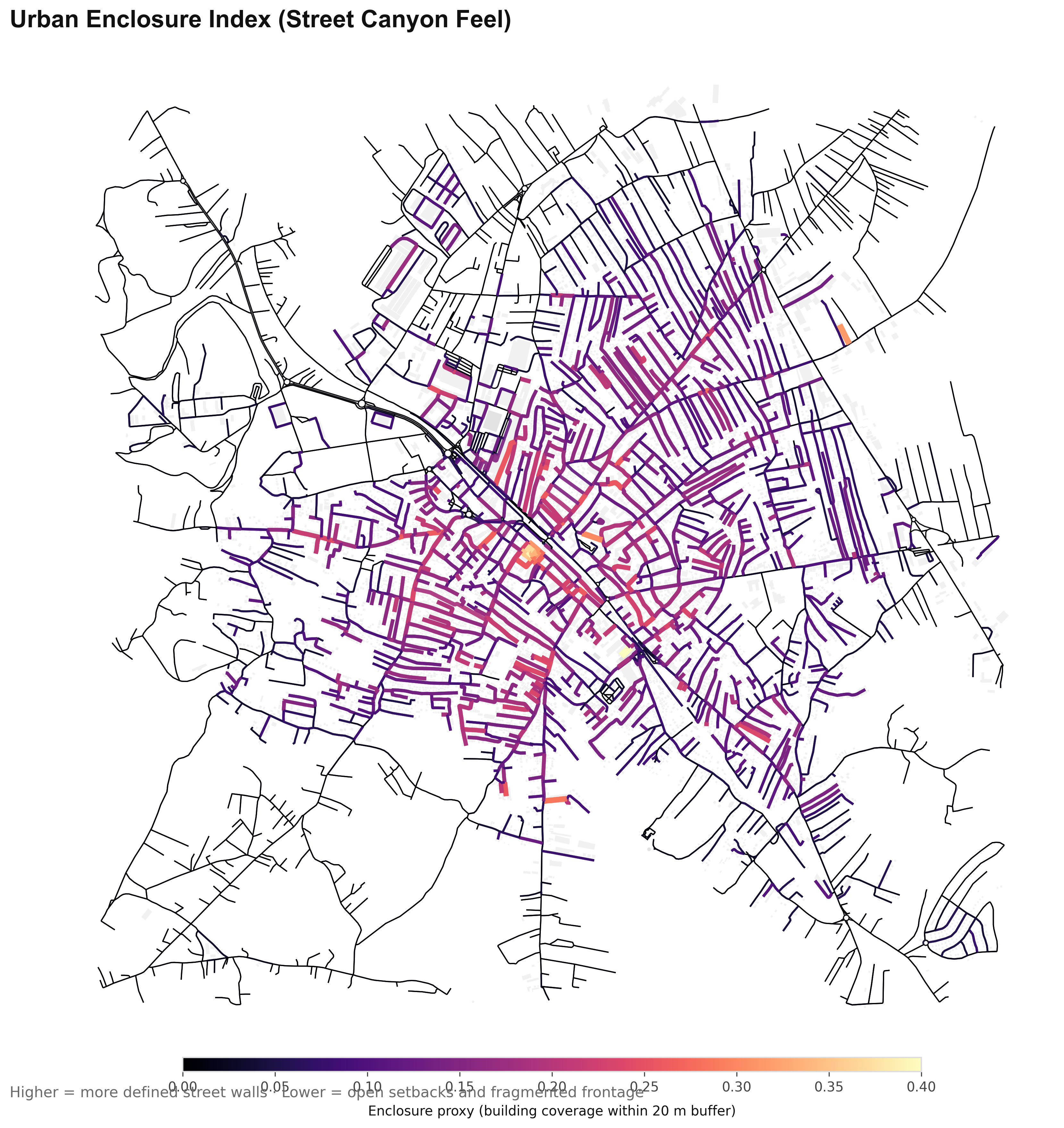
12 Enclosure Index
Research narrative
Abstract
This research deconstructs Ferizaj through computational mapping, moving from historical satellite timelines to network entropy, territorial geometry, service accessibility, and spatial experience metrics. Across these layers, the city emerges as a monocentric organism: a high-energy core with a fragile distribution system. The work exposes a typological bifurcation between a disciplined, street-defined core and an organic, plot-defined periphery. High street orientation entropy (0.981 across 6,354 segments), territorial inequality (Voronoi Gini 0.605; 40–575,000 m²), and service gravity gaps (~330 services; a 15-minute core island) are framed not as defects, but as morphological traits and unrealized urban potential.
Thesis
Ferizaj (municipality population 109,255; 2024 Kosovo census) is a Radial-Linear Organism: a city defined by a highly integrated, high-intensity core that possesses immense concentrated energy, yet struggles to distribute this vitality to its periphery due to a rigid, tree-like street hierarchy and a lack of orbital “ring” connectors. Its growth is a tension between the historic linear discipline of the railway seam and the modern radial expansion of its arterial spines.
Center
42.368323, 21.153178
Radius
2.5 km
Chapter 1
The Fabric (Morphology & Orientation): Nolli Pure, Nolli Inverted, Building Footprint Scale, Courtyard Voids, Street Orientation (Entropy), Typological Alignment, Railway Buildings.
Chapter 2
The Structure (Geometry & Connectivity): Block Permeability, Node Density, Voronoi Mosaic/Overlay, Street Centrality (Closeness), Street Centrality (Betweenness), Space Syntax.
Chapter 3
The Pulse (Intensity & Accessibility): Urban Honeycomb, Service Gravity (15-Minute Access), Urban Convergence (Desire Lines).
Chapter 4
The Experience (Perception & Continuity): Isovist Field, Enclosure Index, Facade Frontage Continuity.
Conclusion
Through these four chapters, Ferizaj is revealed not as a chaotic sprawl, but as a sophisticated, high-energy core with a fragile distribution system. The future does not lie in more expansion, but in internal democratization: stitching the leaky fabric into urban rooms, balancing the territorial mosaic by inserting nodes and connective alternatives, and decentralizing everyday services to reduce the structural burden on the center. This also means filling the missing middle: transitioning from high-rise accumulation to low-rise sprawl through a continuous, medium-density fabric.
Methodological Limitations & Data Notes
All spatial data derive from OpenStreetMap (extract approximate 2025 vintage); core areas are generally complete, but peripheral informal zones may have lower coverage or require manual validation (performed selectively on key samples). The study does not incorporate building heights or floor-area ratios (FAR), so recent vertical intensification in the core is inferred from footprint changes, satellite evidence, and density proxies rather than direct volumetric quantification. The fixed 2.5 km radius window captures the majority of Ferizaj's continuously built-up urban area (municipality population 109,255; 2024 Kosovo census), but boundary effects influence peripheral metrics such as Voronoi territory sizes and block permeability gradients.
References
Batty, M. (2013). The New Science of Cities. MIT Press.
Boeing, G. (2017). OSMnx: New Methods for Acquiring, Constructing, Analyzing, and Visualizing Complex Street Networks. Computers, Environment and Urban Systems, 65, 126–139.
Boeing, G. (2019). Urban Spatial Order: Street Network Orientation, Configuration, and Entropy. Applied Network Science.
Elezi, K., & Sadiki, A. (2019). Architectural reflection in Ferizaj: from Eclecticism to the new wave of Modernism. University of Tetova / University for Business and Technology.
Hillier, B., & Hanson, J. (1984). The Social Logic of Space. Cambridge University Press.
Jacobs, J. (1961). The Death and Life of Great American Cities. Random House.
Lynch, K. (1960). The Image of the City. MIT Press.
Moreno, C. (2020). The 15-Minute City: A Solution to Saving Our Time and Our Planet.
OpenStreetMap contributors. (2025). OpenStreetMap data. https://www.openstreetmap.org
Soria y Mata, A. (1886). The Linear City (Ciudad Lineal). Madrid.
Trancik, R. (1986). Finding Lost Space: Theories of Urban Design. Van Nostrand Reinhold.
USGS. (2024). Landsat Collection 2 Level-2 Science Products. Retrieved from Google Earth Engine. https://earthengine.google.com